Geolocate

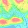
Kilmichael topographic map

Click on the map to display elevation.

About this map

Name: Kilmichael topographic map, elevation, terrain.

Location: Kilmichael, Carrigboy ED, Municipal District of Macroom, County Cork, Munster, Ireland (51.82498 -9.04830 51.84498 -9.02830)

Average elevation: 133 m

Minimum elevation: 68 m

Maximum elevation: 242 m

County Cork trails, hiking, mountain biking, running and outdoor activities

Other topographic maps

Click on a map to view its topography, its elevation and its terrain.
Gear up for your next adventure:

🧴Long-Lasting Sunscreen - Protect against UV rays during long days on the ridges
📚Irish Walking Guides - The best mapped trails in Wicklow, Kerry, and Connemara
🩻Outdoor Health Essentials - Necessary health items for hikes
🎁Outdoor Gift Ideas - Great gifts for adventurers
💨Windbreakers - Protection from strong winds

As an Amazon Associate, this site earns from qualifying purchases at no extra cost to you.