
Thank you for supporting this site ❤️
Make a donation
Make a donation
Gear up for your next adventure:
As an Amazon Associate, this site earns from qualifying purchases at no extra cost to you.
Serzedelo topographic map
Click on the map to display elevation.
Thank you for supporting this site ❤️
Make a donation
Make a donation
Gear up for your next adventure:
As an Amazon Associate, this site earns from qualifying purchases at no extra cost to you.
About this map
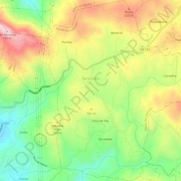
Name: Serzedelo topographic map, elevation, terrain.
Location: Serzedelo, Póvoa de Lanhoso, Braga, Portugal (41.59582 -8.23485 41.63467 -8.18892)
Average elevation: 493 m
Minimum elevation: 304 m
Maximum elevation: 716 m
Thank you for supporting this site ❤️
Make a donation
Make a donation
Gear up for your next adventure:
As an Amazon Associate, this site earns from qualifying purchases at no extra cost to you.