Geolocate

Gettysburg topographic map

Click on the map to display elevation.

About this map
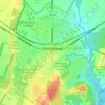
Name: Gettysburg topographic map, elevation, terrain.

Location: Gettysburg, Adams County, Pennsylvania, 17325, United States (39.81581 -77.24664 39.84384 -77.21762)

Average elevation: 161 m

Minimum elevation: 138 m

Maximum elevation: 192 m

Gear up for your next adventure:

🛶Kayaking & Water Sports Gear - Equip for water adventures
🥽UV Protection Sunglasses - Protect eyes on bright days
🔌Travel Adapters - Essential for visitors to charge gear in Ireland
🍽️Camping Utensil Sets - Complete eating sets
🧢Hiking Hats & Caps - Protective headwear for sun and rain

As an Amazon Associate, this site earns from qualifying purchases at no extra cost to you.