
Membruggen topographic map
Interactive map
Click on the map to display elevation.
About this map
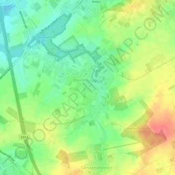
Name: Membruggen topographic map, elevation, terrain.
Location: Membruggen, Riemst, Tongres, Limbourg, Flandre, Belgique (50.80567 5.51354 50.82449 5.55968)
Average elevation: 92 m
Minimum elevation: 63 m
Maximum elevation: 130 m
Other topographic maps
Click on a map to view its topography, its elevation and its terrain.