
Make a donation
Gear up for your next adventure:
As an Amazon Associate, this site earns from qualifying purchases at no extra cost to you.
Ulmbach topographic map
Click on the map to display elevation.
Make a donation
Gear up for your next adventure:
As an Amazon Associate, this site earns from qualifying purchases at no extra cost to you.
Ulmbach
Der Ulmbach entspringt im Westerwald auf einer Höhe von etwa 532 m ü. NN in dem Mischwaldgewann Lehnstruth südlich von Mademühlen. Nur ungefähr einen Kilometer weiter nordwestlich von seinem Quellgebiet befindet sich die Krombachtalsperre.
Make a donation
Gear up for your next adventure:
As an Amazon Associate, this site earns from qualifying purchases at no extra cost to you.
About this map
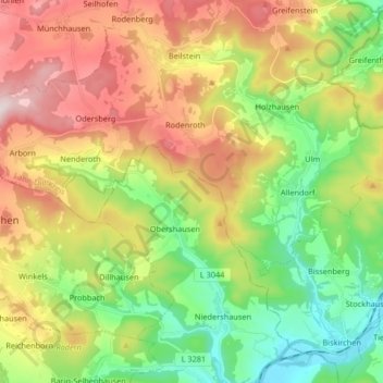
Name: Ulmbach topographic map, elevation, terrain.
Average elevation: 331 m
Minimum elevation: 132 m
Maximum elevation: 606 m
Make a donation
Gear up for your next adventure:
As an Amazon Associate, this site earns from qualifying purchases at no extra cost to you.