
Thank you for supporting this site ❤️
Make a donation
Make a donation
Gear up for your next adventure:
As an Amazon Associate, this site earns from qualifying purchases at no extra cost to you.
Arboriamar topographic map
Click on the map to display elevation.
Thank you for supporting this site ❤️
Make a donation
Make a donation
Gear up for your next adventure:
As an Amazon Associate, this site earns from qualifying purchases at no extra cost to you.
About this map
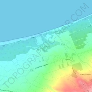
Name: Arboriamar topographic map, elevation, terrain.
Location: Arboriamar, Sòssu/Sorso, Sassari, Sardinien, 07037, Italien (40.80172 8.52842 40.84172 8.56842)
Average elevation: 22 m
Minimum elevation: -1 m
Maximum elevation: 114 m
Thank you for supporting this site ❤️
Make a donation
Make a donation
Gear up for your next adventure:
As an Amazon Associate, this site earns from qualifying purchases at no extra cost to you.