
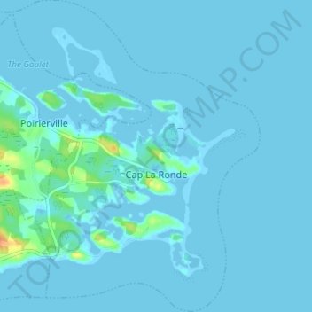
Cap La Ronde topographic map
Interactive map
Click on the map to display elevation.
About this map
Name: Cap La Ronde topographic map, elevation, terrain.
Average elevation: 2 m
Minimum elevation: -5 m
Maximum elevation: 35 m
Other topographic maps
Click on a map to view its topography, its elevation and its terrain.
Battery Provincial Park
Canada > Nova Scotia > Municipality of the County of Richmond > St. Peter's
Average elevation: 9 m
Berry Island
Canada > Nova Scotia > Municipality of the County of Richmond > Martinique
Average elevation: 41 m