
Kizhakkekallada topographic map
Interactive map
Click on the map to display elevation.
About this map
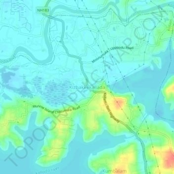
Name: Kizhakkekallada topographic map, elevation, terrain.
Location: Kizhakkekallada, Kollam, Kollam District, Kerala, 691502, India (8.98995 76.63524 9.02995 76.67524)
Average elevation: 10 m
Minimum elevation: -2 m
Maximum elevation: 48 m
Other topographic maps
Click on a map to view its topography, its elevation and its terrain.
Sakthikulangara
Sakthikulangara, Kollam, Kerala, 691581, India
Average elevation: 4 m
Uliyakovil
India > Kerala > Kollam > Kollam
Uliyakovil, Kollam, Kerala, 691001, India
Average elevation: 10 m