
`Ayn al Hammam topographic map
Interactive map
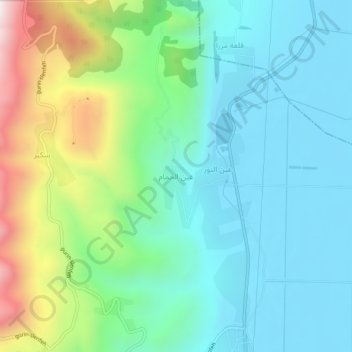
Click on the map to display elevation.
About this map
Name: `Ayn al Hammam topographic map, elevation, terrain.
Average elevation: 394 m
Minimum elevation: 165 m
Maximum elevation: 1,045 m
Other topographic maps
Click on a map to view its topography, its elevation and its terrain.
Sirmaniyah
Sirmaniyah, Al-Ziyarah Subdistrict, Al-Suqaylabiyah District, Hama Governorate, Syria
Average elevation: 422 m
Suqaylabiyah
Suqaylabiyah, Al-Suqaylabiyah Subdistrict, Al-Suqaylabiyah District, Hama Governorate, Syria
Average elevation: 212 m
Qarqur
Qarqur, Al-Ziyarah Subdistrict, Al-Suqaylabiyah District, Hama Governorate, Syria
Average elevation: 174 m
Al Qanatir
Al Qanatir, Al-Hamraa Subdistrict, Hama District, Hama Governorate, Syria
Average elevation: 311 m
Salamiyah
Salamiyah, Salamiyah Subdistrict, Salamiyah District, Hama Governorate, Syria
Average elevation: 500 m
Al Hawash
Al Hawash, Qalaat Al-Madiq Subdistrict, Al-Suqaylabiyah District, Hama Governorate, Syria
Average elevation: 240 m
`Atshan
`Atshan, Suran Subdistrict, Hama District, Hama Governorate, Syria
Average elevation: 351 m
Tayyibat al Imam
Syria > Hama Governorate > Tayyibat al Imam
Tayyibat al Imam, Suran Subdistrict, Hama District, Hama Governorate, Syria
Average elevation: 335 m
Umm Mil
Syria > Hama Governorate > Umm Mil
Umm Mil, Barri Al-Sharqi Subdistrict, Salamiyah District, Hama Governorate, Syria
Average elevation: 605 m
Masyaf
Syria > Hama Governorate > Masyaf
Masyaf, Masyaf Subdistrict, Masyaf District, Hama Governorate, Syria
Average elevation: 588 m
Hama
Hama, Hama Subdistrict, Hama District, Hama Governorate, Syria
Average elevation: 363 m
Rashah
Syria > Hama Governorate > Rashah
Rashah, Salhab Subdistrict, Al-Suqaylabiyah District, Hama Governorate, Syria
Average elevation: 781 m
Tall Sikkine Saroute
Syria > Hama Governorate > Tall Sikkine Saroute
Tall Sikkine Saroute, Hama Subdistrict, Hama District, Hama Governorate, Syria
Average elevation: 284 m
Suran
Suran, Suran Subdistrict, Hama District, Hama Governorate, Syria
Average elevation: 347 m
Kafr Zita Subdistrict
Kafr Zita Subdistrict, Mahardah District, Hama Governorate, Syria
Average elevation: 287 m
Al Madaba
Al Madaba, Al-Saan Subdistrict, Salamiyah District, Hama Governorate, Syria
Average elevation: 437 m
Ma`an
Ma`an, Suran Subdistrict, Hama District, Hama Governorate, Syria
Average elevation: 347 m
مغارة بيت الوادي
Syria > Hama Governorate > Wadi al `Uyun
مغارة بيت الوادي, 54, Wadi al `Uyun, Wadi Al-Uyun Subdistrict, Masyaf District, Hama Governorate, Syria
Average elevation: 639 m
Qur as Sayyadah
Qur as Sayyadah, Sabburah Subdistrict, Salamiyah District, Hama Governorate, Syria
Average elevation: 542 m
Muhradah
Muhradah, Mahardah Subdistrict, Mahardah District, Hama Governorate, Syria
Average elevation: 268 m
Halfaya
Halfaya, Mahardah Subdistrict, Mahardah District, Hama Governorate, Syria
Average elevation: 278 m
Kafr Zayta
Kafr Zayta, Kafr Zita Subdistrict, Mahardah District, Hama Governorate, Syria
Average elevation: 305 m