
Lory topographic map
Click on the map to display elevation.
About this map
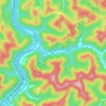
Name: Lory topographic map, elevation, terrain.
Location: Lory, Boone County, West Virginia, 25529, United States (38.10982 -81.84735 38.14982 -81.80735)
Average elevation: 313 m
Minimum elevation: 193 m
Maximum elevation: 462 m
Other topographic maps
Click on a map to view its topography, its elevation and its terrain.