Geolocate

Layangan topographic map

Click on the map to display elevation.

About this map

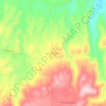
Name: Layangan topographic map, elevation, terrain.

Location: Layangan, North Cotabato, Soccsksargen, Philippines (7.26397 124.96205 7.30397 125.00205)

Average elevation: 337 m

Minimum elevation: 161 m

Maximum elevation: 501 m

Gear up for your next adventure:

Solar Multisport Watches - Advanced mapping and GPS tracking for endurance hikers
🔦LED Flashlights - Bright, durable flashlights for outdoor use
🧊Winter Boot Traction - Grip for icy paths in the Mourne or Derryveagh mountains
🛸Lightweight Camera Drones - Capture stunning aerial topographic views of the landscape
🔪Multi‑Tools & Knives - Versatile tools for outdoor tasks

As an Amazon Associate, this site earns from qualifying purchases at no extra cost to you.