
Thank you for supporting this site ❤️
Make a donation
Make a donation
Gear up for your next adventure:
As an Amazon Associate, this site earns from qualifying purchases at no extra cost to you.
Fernando topographic map
Click on the map to display elevation.
Thank you for supporting this site ❤️
Make a donation
Make a donation
Gear up for your next adventure:
As an Amazon Associate, this site earns from qualifying purchases at no extra cost to you.
About this map
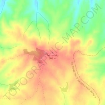
Name: Fernando topographic map, elevation, terrain.
Location: Fernando, Ponte de Sor, Portalegre, 7400-505, Portugal (39.27982 -7.88295 39.27992 -7.88285)
Average elevation: 228 m
Minimum elevation: 181 m
Maximum elevation: 263 m
Thank you for supporting this site ❤️
Make a donation
Make a donation
Gear up for your next adventure:
As an Amazon Associate, this site earns from qualifying purchases at no extra cost to you.