
Thank you for supporting this site ❤️
Make a donation
Make a donation
Gear up for your next adventure:
As an Amazon Associate, this site earns from qualifying purchases at no extra cost to you.
Pfunders topographic map
Click on the map to display elevation.
Thank you for supporting this site ❤️
Make a donation
Make a donation
Gear up for your next adventure:
As an Amazon Associate, this site earns from qualifying purchases at no extra cost to you.
About this map
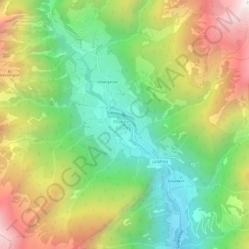
Name: Pfunders topographic map, elevation, terrain.
Location: Pfunders, Vintl, Pustertal, Bozen, Trentino-Südtirol, Italien (46.86733 11.68871 46.90733 11.72871)
Average elevation: 1,604 m
Minimum elevation: 965 m
Maximum elevation: 2,512 m
Thank you for supporting this site ❤️
Make a donation
Make a donation
Gear up for your next adventure:
As an Amazon Associate, this site earns from qualifying purchases at no extra cost to you.