
Thank you for supporting this site ❤️
Make a donation
Make a donation
Gear up for your next adventure:
As an Amazon Associate, this site earns from qualifying purchases at no extra cost to you.
Meenangadi topographic map
Click on the map to display elevation.
Thank you for supporting this site ❤️
Make a donation
Make a donation
Gear up for your next adventure:
As an Amazon Associate, this site earns from qualifying purchases at no extra cost to you.
About this map
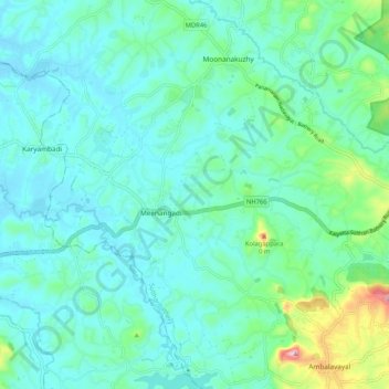
Name: Meenangadi topographic map, elevation, terrain.
Location: Meenangadi, Sulthanbathery, Wayanad, Kerala, India (11.61316 76.13441 11.71517 76.22074)
Average elevation: 785 m
Minimum elevation: 727 m
Maximum elevation: 1,052 m
Thank you for supporting this site ❤️
Make a donation
Make a donation
Gear up for your next adventure:
As an Amazon Associate, this site earns from qualifying purchases at no extra cost to you.