
Make a donation
Gear up for your next adventure:
As an Amazon Associate, this site earns from qualifying purchases at no extra cost to you.
Gun-ob topographic map
Click on the map to display elevation.
Make a donation
Gear up for your next adventure:
As an Amazon Associate, this site earns from qualifying purchases at no extra cost to you.
About this map
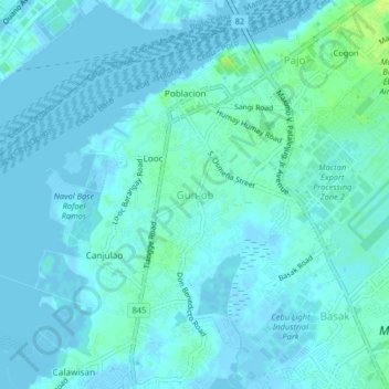
Name: Gun-ob topographic map, elevation, terrain.
Location: Gun-ob, Lapu-Lapu, Central Visayas, 6016, Philippines (10.28205 123.93091 10.32205 123.97091)
Average elevation: 3 m
Minimum elevation: -3 m
Maximum elevation: 14 m
Make a donation
Gear up for your next adventure:
As an Amazon Associate, this site earns from qualifying purchases at no extra cost to you.
Other topographic maps
Click on a map to view its topography, its elevation and its terrain.
Olango Island
Philippines > Lapu-Lapu > Tingo
The Olango group of islands is an island group composed of the island of Olango and six satellite islets. The six neighboring islets are Sulpa, Gilutongan (also spelled Hilutangan), Nalusuan, Caohagan, Pangan-an, and Camungi. These are bound by continuous fringing reefs (steep reef wall on the west and sloping…
Average elevation: 2 m
Make a donation
Gear up for your next adventure:
As an Amazon Associate, this site earns from qualifying purchases at no extra cost to you.