Geolocate

Curraghinalt topographic map

Click on the map to display elevation.

About this map

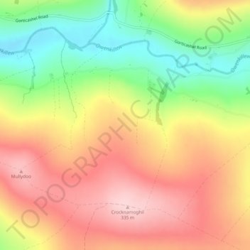
Name: Curraghinalt topographic map, elevation, terrain.

Location: Curraghinalt, County Tyrone, Ulster, Northern Ireland, United Kingdom (54.71022 -7.12267 54.72868 -7.09319)

Average elevation: 229 m

Minimum elevation: 106 m

Maximum elevation: 333 m

Other topographic maps

Click on a map to view its topography, its elevation and its terrain.

Coagh

United Kingdom > Northern Ireland > County Tyrone

Average elevation: 43 m

Clady

United Kingdom > Northern Ireland > County Tyrone

Average elevation: 46 m

Eglish

United Kingdom > Northern Ireland > County Tyrone

Average elevation: 195 m

Craig

United Kingdom > Northern Ireland > County Tyrone

Average elevation: 231 m

Gear up for your next adventure:

🪓Camping Axes & Hatchets - Wood cutting tools for campsite prep
🌲Survival Gear - Equipment for outdoor survival situations
🍴Camp Kitchen Kits - Lightweight nesting pots and pans for backpacking
🧴Anti-Chafe Sticks - Prevent friction during long distance walking
🔌Travel Adapters - Essential for visitors to charge gear in Ireland

As an Amazon Associate, this site earns from qualifying purchases at no extra cost to you.