
Kuvansi topographic map
Interactive map
Click on the map to display elevation.
About this map
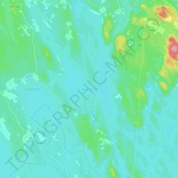
Name: Kuvansi topographic map, elevation, terrain.
Average elevation: 108 m
Minimum elevation: 93 m
Maximum elevation: 207 m
Other topographic maps
Click on a map to view its topography, its elevation and its terrain.
Suontee
Finland > Norra Savolax > Suonenjoki
Suontee, Suonenjoki, Inre Savolax ekonomiska region, Norra Savolax, Östra Finlands regionförvaltningsverk, Fasta Finland, 77960, Finland
Average elevation: 109 m