
Thank you for supporting this site ❤️
Make a donation
Make a donation
Gear up for your next adventure:
As an Amazon Associate, this site earns from qualifying purchases at no extra cost to you.
Hillman topographic map
Click on the map to display elevation.
Thank you for supporting this site ❤️
Make a donation
Make a donation
Gear up for your next adventure:
As an Amazon Associate, this site earns from qualifying purchases at no extra cost to you.
About this map
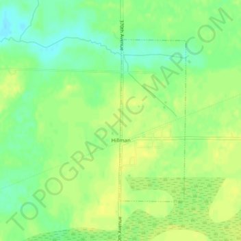
Name: Hillman topographic map, elevation, terrain.
Location: Hillman, Morrison County, Minnesota, 56338, United States (45.99724 -93.89407 46.01542 -93.88338)
Average elevation: 400 m
Minimum elevation: 388 m
Maximum elevation: 406 m
Thank you for supporting this site ❤️
Make a donation
Make a donation
Gear up for your next adventure:
As an Amazon Associate, this site earns from qualifying purchases at no extra cost to you.
Other topographic maps
Click on a map to view its topography, its elevation and its terrain.
Suburban Mobile Home Park
United States > Minnesota > Morrison County > Little Falls
Average elevation: 349 m