
Hausleiten topographic map
Interactive map
Click on the map to display elevation.
About this map
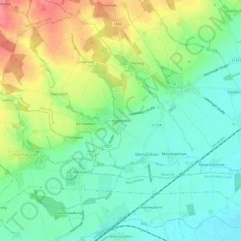
Name: Hausleiten topographic map, elevation, terrain.
Location: Hausleiten, Oftering, Bezirk Linz-Land, 4064, Österreich (48.20866 14.10059 48.24866 14.14059)
Average elevation: 322 m
Minimum elevation: 293 m
Maximum elevation: 371 m