
Tate County topographic map
Interactive map
Click on the map to display elevation.
About this map
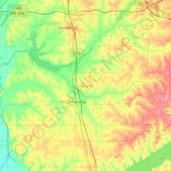
Name: Tate County topographic map, elevation, terrain.
Location: Tate County, Misisipi, Estados Unidos de América (34.55366 -90.24429 34.77309 -89.66854)
Average elevation: 94 m
Minimum elevation: 48 m
Maximum elevation: 176 m
Other topographic maps
Click on a map to view its topography, its elevation and its terrain.
Philipp
Estados Unidos de América > Misisipi > Tallahatchie County
Philipp, Tallahatchie County, Misisipi, 38950, Estados Unidos de América
Average elevation: 41 m