
La Saline les Bains topographic map
Interactive map
Click on the map to display elevation.
About this map
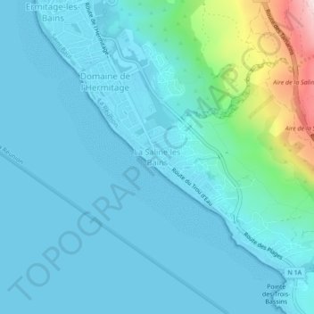
Name: La Saline les Bains topographic map, elevation, terrain.
Location: La Saline les Bains, Saint-Paul, La Réunion, 97434, France (-21.11498 55.21713 -21.07498 55.25713)
Average elevation: 52 m
Minimum elevation: 0 m
Maximum elevation: 385 m