
Make a donation
Gear up for your next adventure:
As an Amazon Associate, this site earns from qualifying purchases at no extra cost to you.
Ponte Vedra Beach topographic map
Click on the map to display elevation.
Make a donation
Gear up for your next adventure:
As an Amazon Associate, this site earns from qualifying purchases at no extra cost to you.
Ponte Vedra Beach
Ponte Vedra Beach is characterized by its gently rolling terrain that is primarily flat and lies only about 15 feet above sea level. The landscape is predominantly shaped by coastal dunes and the proximity to the Atlantic Ocean, resulting in sandy beaches interspersed with vegetation typical of barrier island ecosystems. The area is part of the Guana Tolomato Matanzas National Estuarine Research Reserve, which contributes to its diverse coastal habitats, including estuaries and wetlands. This low-lying terrain is susceptible to erosion and sea level rise, making its elevation a crucial factor in environmental discussions. The interplay between the beach, dunes, and coastal wetlands creates a unique and rich ecosystem that attracts both residents and visitors seeking natural beauty and outdoor activities.
Make a donation
Gear up for your next adventure:
As an Amazon Associate, this site earns from qualifying purchases at no extra cost to you.
About this map
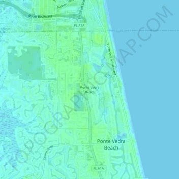
Name: Ponte Vedra Beach topographic map, elevation, terrain.
Average elevation: 3 m
Minimum elevation: -1 m
Maximum elevation: 9 m
Make a donation
Gear up for your next adventure:
As an Amazon Associate, this site earns from qualifying purchases at no extra cost to you.
Other topographic maps
Click on a map to view its topography, its elevation and its terrain.
DeLeon Shores Park
United States > Florida > Saint Johns County > Ponte Vedra Beach > Palm Valley
Average elevation: 4 m
Make a donation
Gear up for your next adventure:
As an Amazon Associate, this site earns from qualifying purchases at no extra cost to you.