
Belleek topographic map
Interactive map
Click on the map to display elevation.
About this map
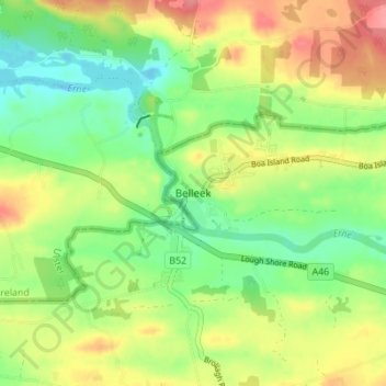
Name: Belleek topographic map, elevation, terrain.
Average elevation: 62 m
Minimum elevation: 29 m
Maximum elevation: 104 m
Other topographic maps
Click on a map to view its topography, its elevation and its terrain.
Tomregan
United Kingdom > Northern Ireland > County Fermanagh > Teemore
Tomregan, Teemore, County Fermanagh, Northern Ireland, BT92 9DD, United Kingdom
Average elevation: 144 m
Curraghmore
United Kingdom > Northern Ireland > County Fermanagh
Curraghmore, County Fermanagh, Northern Ireland, United Kingdom
Average elevation: 61 m