
Yichun City topographic map
Interactive map
Click on the map to display elevation.
About this map
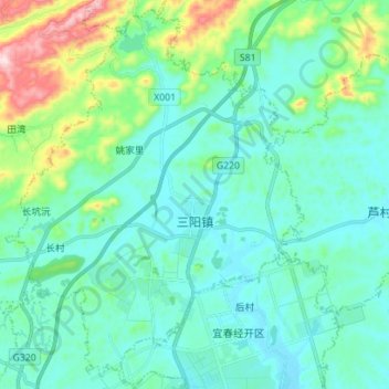
Name: Yichun City topographic map, elevation, terrain.
Location: Sanyang, Yuanzhou District, Yichun City, Jiangxi, China (27.86923 114.32008 27.99326 114.42788)
Average elevation: 165 m
Minimum elevation: 84 m
Maximum elevation: 512 m
Other topographic maps
Click on a map to view its topography, its elevation and its terrain.
Yichun City
China > Jiangxi > Yichun City
Mabu, Wanzai County, Yichun City, Jiangxi, China
Average elevation: 177 m