
Thank you for supporting this site ❤️
Make a donation
Make a donation
Gear up for your next adventure:
As an Amazon Associate, this site earns from qualifying purchases at no extra cost to you.
Pooh topographic map
Click on the map to display elevation.
Thank you for supporting this site ❤️
Make a donation
Make a donation
Gear up for your next adventure:
As an Amazon Associate, this site earns from qualifying purchases at no extra cost to you.
About this map
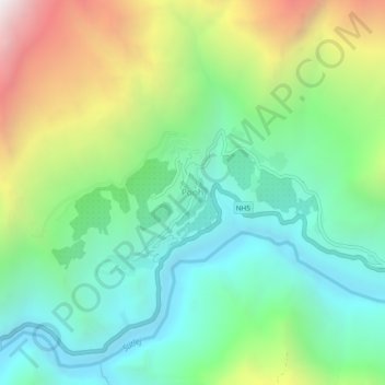
Name: Pooh topographic map, elevation, terrain.
Location: Pooh, Poo district, Kinnaur, Himachal Pradesh, 172111, India (31.74159 78.56393 31.78159 78.60393)
Average elevation: 3,067 m
Minimum elevation: 2,397 m
Maximum elevation: 4,447 m
Thank you for supporting this site ❤️
Make a donation
Make a donation
Gear up for your next adventure:
As an Amazon Associate, this site earns from qualifying purchases at no extra cost to you.