
Thank you for supporting this site ❤️
Make a donation
Make a donation
Gear up for your next adventure:
As an Amazon Associate, this site earns from qualifying purchases at no extra cost to you.
Cloon topographic map
Click on the map to display elevation.
Thank you for supporting this site ❤️
Make a donation
Make a donation
Gear up for your next adventure:
As an Amazon Associate, this site earns from qualifying purchases at no extra cost to you.
About this map
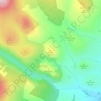
Name: Cloon topographic map, elevation, terrain.
Location: Cloon, Perth and Kinross, Scotland, KY13 0NY, United Kingdom (56.22312 -3.55430 56.22322 -3.55420)
Average elevation: 282 m
Minimum elevation: 160 m
Maximum elevation: 474 m
Thank you for supporting this site ❤️
Make a donation
Make a donation
Gear up for your next adventure:
As an Amazon Associate, this site earns from qualifying purchases at no extra cost to you.