
Amtdi topographic map
Interactive map
Click on the map to display elevation.
About this map
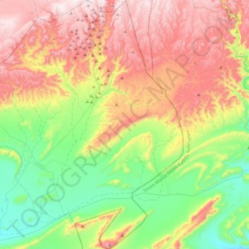
Name: Amtdi topographic map, elevation, terrain.
Average elevation: 950 m
Minimum elevation: 597 m
Maximum elevation: 1,419 m
Other topographic maps
Click on a map to view its topography, its elevation and its terrain.
Timoulay
Timoulay, caïdat d'Ifran Atlas Saghir, cercle de Bouizakarne, Province de Guelmim, Guelmim-Oued Noun, 81053, Maroc
Average elevation: 664 m