
Thank you for supporting this site ❤️
Make a donation
Make a donation
Gear up for your next adventure:
As an Amazon Associate, this site earns from qualifying purchases at no extra cost to you.
Ilsanseo-gu topographic map
Click on the map to display elevation.
Thank you for supporting this site ❤️
Make a donation
Make a donation
Gear up for your next adventure:
As an Amazon Associate, this site earns from qualifying purchases at no extra cost to you.
About this map
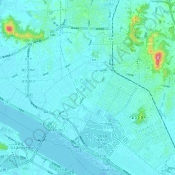
Name: Ilsanseo-gu topographic map, elevation, terrain.
Location: Ilsanseo-gu, Goyang-si, Gyeonggi, South Korea (37.64752 126.67039 37.70729 126.78118)
Average elevation: 20 m
Minimum elevation: -16 m
Maximum elevation: 208 m
Thank you for supporting this site ❤️
Make a donation
Make a donation
Gear up for your next adventure:
As an Amazon Associate, this site earns from qualifying purchases at no extra cost to you.