
Thank you for supporting this site ❤️
Make a donation
Make a donation
Gear up for your next adventure:
As an Amazon Associate, this site earns from qualifying purchases at no extra cost to you.
Siniolchu topographic map
Click on the map to display elevation.
Thank you for supporting this site ❤️
Make a donation
Make a donation
Gear up for your next adventure:
As an Amazon Associate, this site earns from qualifying purchases at no extra cost to you.
About this map
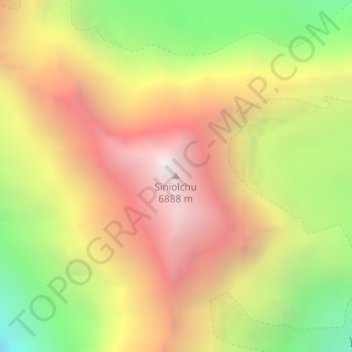
Name: Siniolchu topographic map, elevation, terrain.
Location: Siniolchu, Chungthang, Mangan, Sikkim, India (27.71118 88.31770 27.71128 88.31780)
Average elevation: 5,890 m
Minimum elevation: 4,786 m
Maximum elevation: 6,873 m
Thank you for supporting this site ❤️
Make a donation
Make a donation
Gear up for your next adventure:
As an Amazon Associate, this site earns from qualifying purchases at no extra cost to you.