Geolocate

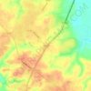
Sandy Point State Forest topographic map

Click on the map to display elevation.

About this map

Name: Sandy Point State Forest topographic map, elevation, terrain.

Location: Sandy Point State Forest, King William County, Virginia, United States (37.65946 -76.95401 37.69461 -76.90690)

Average elevation: 13 m

Minimum elevation: -7 m

Maximum elevation: 42 m

Other topographic maps

Click on a map to view its topography, its elevation and its terrain.

Aylett

United States > Virginia > King William County

Average elevation: 19 m

Manquin

United States > Virginia > King William County

Average elevation: 27 m

Aylett

United States > Virginia > King William County

Average elevation: 19 m

Gear up for your next adventure:

☕Vacuum Insulated Flasks - Keep tea or coffee hot for 12 hours on the summit
🛶Waterproof Dry Bags - Keep electronics and clothes dry during wet treks
🛡️Protective Bike Gear - Helmets & pads for safe rides
🥾Mountaineering Boots - Heavy‑duty boots for rugged peaks
🔭Laser Distance Meters - Professional precision measuring for site surveys

As an Amazon Associate, this site earns from qualifying purchases at no extra cost to you.