
Reşadiye Belediyesi topographic map
Interactive map
Click on the map to display elevation.
About this map
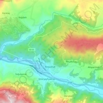
Name: Reşadiye Belediyesi topographic map, elevation, terrain.
Location: Reşadiye Belediyesi, Reşadiye, Tokat, Black Sea Region, Turkey (40.37569 37.29362 40.42907 37.38606)
Average elevation: 749 m
Minimum elevation: 474 m
Maximum elevation: 1,312 m
Other topographic maps
Click on a map to view its topography, its elevation and its terrain.