
星甸街道 topographic map
Interactive map
Click on the map to display elevation.
About this map
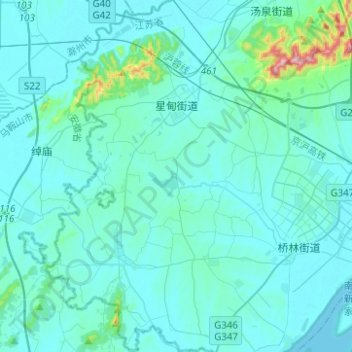
Name: 星甸街道 topographic map, elevation, terrain.
Location: 星甸街道, 浦口区, 南京市, 江苏省, 中国 (31.88566 118.33459 32.09640 118.47946)
Average elevation: 34 m
Minimum elevation: 1 m
Maximum elevation: 415 m
Other topographic maps
Click on a map to view its topography, its elevation and its terrain.