
Thank you for supporting this site ❤️
Make a donation
Make a donation
Gear up for your next adventure:
As an Amazon Associate, this site earns from qualifying purchases at no extra cost to you.
Pany topographic map
Click on the map to display elevation.
Thank you for supporting this site ❤️
Make a donation
Make a donation
Gear up for your next adventure:
As an Amazon Associate, this site earns from qualifying purchases at no extra cost to you.
About this map
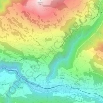
Name: Pany topographic map, elevation, terrain.
Location: Pany, Luzein, Prättigau/Davos, Grisons, 7243, Switzerland (46.90841 9.75144 46.94841 9.79144)
Average elevation: 1,236 m
Minimum elevation: 758 m
Maximum elevation: 2,012 m
Thank you for supporting this site ❤️
Make a donation
Make a donation
Gear up for your next adventure:
As an Amazon Associate, this site earns from qualifying purchases at no extra cost to you.