
Thank you for supporting this site ❤️
Make a donation
Make a donation
Gear up for your next adventure:
As an Amazon Associate, this site earns from qualifying purchases at no extra cost to you.
Coyahuasi topographic map
Click on the map to display elevation.
Thank you for supporting this site ❤️
Make a donation
Make a donation
Gear up for your next adventure:
As an Amazon Associate, this site earns from qualifying purchases at no extra cost to you.
About this map
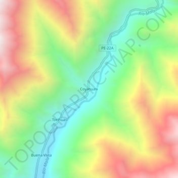
Name: Coyahuasi topographic map, elevation, terrain.
Location: Coyahuasi, Calango, Cañete, Lima, Perú (-12.44255 -76.43558 -12.40255 -76.39558)
Average elevation: 1,304 m
Minimum elevation: 708 m
Maximum elevation: 2,090 m
Thank you for supporting this site ❤️
Make a donation
Make a donation
Gear up for your next adventure:
As an Amazon Associate, this site earns from qualifying purchases at no extra cost to you.