
The Quill topographic map
Interactive map
Click on the map to display elevation.
About this map
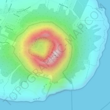
Name: The Quill topographic map, elevation, terrain.
Location: The Quill, Oranjestad, Sint Eustatius, Niederlande (17.47613 -62.95999 17.47623 -62.95989)
Average elevation: 143 m
Minimum elevation: 0 m
Maximum elevation: 559 m