
Make a donation
Gear up for your next adventure:
As an Amazon Associate, this site earns from qualifying purchases at no extra cost to you.
Lalaye topographic map
Click on the map to display elevation.
Make a donation
Gear up for your next adventure:
As an Amazon Associate, this site earns from qualifying purchases at no extra cost to you.
Lalaye
The village itself is positioned at the lower end of the valley, having an average elevation of just 310 meters, shortly before the Charbes stream and the Urbeis Giessen converge. The houses are stretched along the south facing side of the narrow Charbes valley.
Make a donation
Gear up for your next adventure:
As an Amazon Associate, this site earns from qualifying purchases at no extra cost to you.
About this map
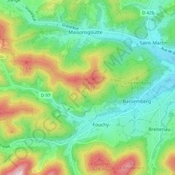
Name: Lalaye topographic map, elevation, terrain.
Average elevation: 497 m
Minimum elevation: 299 m
Maximum elevation: 806 m
Make a donation
Gear up for your next adventure:
As an Amazon Associate, this site earns from qualifying purchases at no extra cost to you.