
Berkeley County topographic map
Interactive map
Click on the map to display elevation.
About this map
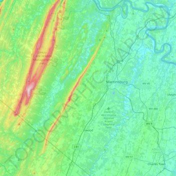
Name: Berkeley County topographic map, elevation, terrain.
Location: Berkeley County, West Virginia, United States of America (39.26440 -78.22991 39.62127 -77.82342)
Average elevation: 203 m
Minimum elevation: 95 m
Maximum elevation: 655 m
Other topographic maps
Click on a map to view its topography, its elevation and its terrain.
Lindside
United States of America > West Virginia > Lindside
Lindside, Monroe County, West Virginia, United States of America
Average elevation: 652 m
Bother Knob
United States of America > West Virginia
Bother Knob, Pendleton County, West Virginia, United States of America
Average elevation: 1,105 m
Huntington
United States of America > West Virginia > Huntington
Huntington, Cabell County, West Virginia, United States of America
Average elevation: 218 m
Deep Water
United States of America > West Virginia > Deep Water
Deep Water, Fayette County, West Virginia, 25147, United States of America
Average elevation: 355 m