
Thank you for supporting this site ❤️
Make a donation
Make a donation
Gear up for your next adventure:
As an Amazon Associate, this site earns from qualifying purchases at no extra cost to you.
Candelaria topographic map
Click on the map to display elevation.
Thank you for supporting this site ❤️
Make a donation
Make a donation
Gear up for your next adventure:
As an Amazon Associate, this site earns from qualifying purchases at no extra cost to you.
About this map
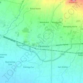
Name: Candelaria topographic map, elevation, terrain.
Location: Candelaria, Quezon, Calabarzon, 4323, Philippines (13.89347 121.38249 13.97347 121.46249)
Average elevation: 84 m
Minimum elevation: 24 m
Maximum elevation: 330 m
Thank you for supporting this site ❤️
Make a donation
Make a donation
Gear up for your next adventure:
As an Amazon Associate, this site earns from qualifying purchases at no extra cost to you.