Geolocate

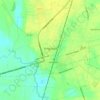
Cades topographic map

Click on the map to display elevation.

About this map

Name: Cades topographic map, elevation, terrain.

Location: Cades, Williamsburg County, South Carolina, United States (33.76655 -79.80257 33.80655 -79.76257)

Average elevation: 21 m

Minimum elevation: 15 m

Maximum elevation: 26 m

Other topographic maps

Click on a map to view its topography, its elevation and its terrain.
Gear up for your next adventure:

📡Satellite Messengers - Emergency communication for remote areas without signal
🔦Everyday Carry Torches - Reliable backup light for your hiking pack
🧊Winter Boot Traction - Grip for icy paths in the Mourne or Derryveagh mountains
🧥Packable Down Jackets - High warmth-to-weight ratio for summit breaks
📦Gear Organizers - Organize outdoor equipment

As an Amazon Associate, this site earns from qualifying purchases at no extra cost to you.