
Thank you for supporting this site ❤️
Make a donation
Make a donation
Gear up for your next adventure:
As an Amazon Associate, this site earns from qualifying purchases at no extra cost to you.
Distrito 6 topographic map
Click on the map to display elevation.
Thank you for supporting this site ❤️
Make a donation
Make a donation
Gear up for your next adventure:
As an Amazon Associate, this site earns from qualifying purchases at no extra cost to you.
About this map
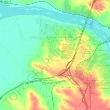
Name: Distrito 6 topographic map, elevation, terrain.
Location: Distrito 6, Mérida, Badajoz, Extremadura, España (38.90072 -6.39600 38.93149 -6.34177)
Average elevation: 223 m
Minimum elevation: 195 m
Maximum elevation: 261 m
Thank you for supporting this site ❤️
Make a donation
Make a donation
Gear up for your next adventure:
As an Amazon Associate, this site earns from qualifying purchases at no extra cost to you.