
Taylorsville topographic map
Interactive map
Click on the map to display elevation.
Taylorsville
The land on which Taylorsville is located is part of an interconnected alluvial plain that was formed by the wearing down of the Wasatch and Oquirrh Mountains to the east and west. Beneath the surface, Taylorsville sits on more than a kilometer of unconsolidated rock, sand, and clay. The inactive Taylorsville Fault has been traced down the center of the Salt Lake Valley. Lake Bonneville shaped the topography of the area and deposited lake bottom clay and sand. As Lake Bonneville dried up over the past 14,000 years, the salt from the breakdown of rock remains, making the soil alkaline. Like most desert soils, it has little organic material and is hard to work.
About this map
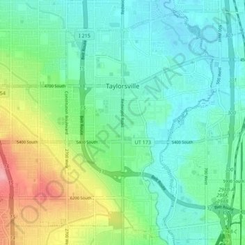
Name: Taylorsville topographic map, elevation, terrain.
Location: Taylorsville, Salt Lake County, Utah, United States (40.62985 -111.99155 40.68633 -111.90783)
Average elevation: 1,325 m
Minimum elevation: 1,293 m
Maximum elevation: 1,410 m
Other topographic maps
Click on a map to view its topography, its elevation and its terrain.
South Valence Drainage
United States > Utah > Salt Lake County > West Jordan
Average elevation: 1,388 m