Geolocate

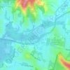
Umina Beach topographic map

Click on the map to display elevation.

About this map

Name: Umina Beach topographic map, elevation, terrain.

Location: Umina Beach, Gosford, New South Wales, Australia (-33.53554 151.29648 -33.50285 151.32868)

Average elevation: 38 m

Minimum elevation: -2 m

Maximum elevation: 183 m

Other topographic maps

Click on a map to view its topography, its elevation and its terrain.
Mount Elliot

Australia > New South Wales > Gosford

Average elevation: 92 m

Mount White

Australia > New South Wales > Gosford

Average elevation: 139 m

Wyong River

Australia > New South Wales > Gosford

Average elevation: 175 m

Wamberal Beach

Australia > New South Wales > Gosford

Average elevation: 7 m

Erina Creek

Australia > New South Wales > Gosford

Average elevation: 23 m

Gear up for your next adventure:

🌿Irish Flora Guides - Identify plants while exploring the countryside
🥾Men's Waterproof Boots - Sturdy footwear for wet and boggy Irish terrain
🧥Gore-Tex Rain Jackets - Breathable and fully waterproof shells for Irish weather
📡Satellite Messengers - Emergency communication for remote areas without signal
🥛Insulated Flasks - Keep drinks hot or cold

As an Amazon Associate, this site earns from qualifying purchases at no extra cost to you.