
Thank you for supporting this site ❤️
Make a donation
Make a donation
Gear up for your next adventure:
As an Amazon Associate, this site earns from qualifying purchases at no extra cost to you.
Corona topographic map
Click on the map to display elevation.
Thank you for supporting this site ❤️
Make a donation
Make a donation
Gear up for your next adventure:
As an Amazon Associate, this site earns from qualifying purchases at no extra cost to you.
About this map
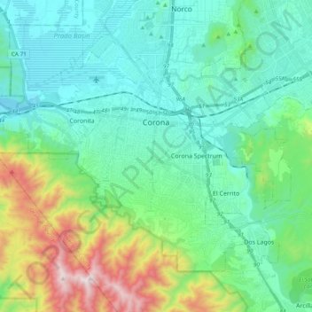
Name: Corona topographic map, elevation, terrain.
Location: Corona, Riverside County, California, United States (33.80001 -117.67318 33.91616 -117.48381)
Average elevation: 377 m
Minimum elevation: 133 m
Maximum elevation: 1,198 m
Thank you for supporting this site ❤️
Make a donation
Make a donation
Gear up for your next adventure:
As an Amazon Associate, this site earns from qualifying purchases at no extra cost to you.
Other topographic maps
Click on a map to view its topography, its elevation and its terrain.
Lake Elsinore
United States > California > Riverside County > Lake Elsinore > Lake Elsinore
Average elevation: 428 m