
西屯 topographic map
Interactive map
Click on the map to display elevation.
About this map
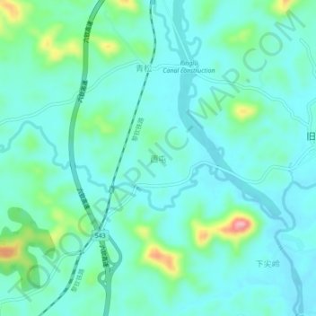
Name: 西屯 topographic map, elevation, terrain.
Location: 西屯, 钦州市, 广西壮族自治区, 中国 (22.37750 108.89500 22.41750 108.93500)
Average elevation: 67 m
Minimum elevation: 38 m
Maximum elevation: 185 m
Other topographic maps
Click on a map to view its topography, its elevation and its terrain.