
Thank you for supporting this site ❤️
Make a donation
Make a donation
Gear up for your next adventure:
As an Amazon Associate, this site earns from qualifying purchases at no extra cost to you.
Swanland topographic map
Click on the map to display elevation.
Thank you for supporting this site ❤️
Make a donation
Make a donation
Gear up for your next adventure:
As an Amazon Associate, this site earns from qualifying purchases at no extra cost to you.
About this map
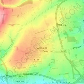
Name: Swanland topographic map, elevation, terrain.
Location: Swanland, East Riding of Yorkshire, England, United Kingdom (53.72150 -0.52286 53.76122 -0.46346)
Average elevation: 62 m
Minimum elevation: 12 m
Maximum elevation: 114 m
Thank you for supporting this site ❤️
Make a donation
Make a donation
Gear up for your next adventure:
As an Amazon Associate, this site earns from qualifying purchases at no extra cost to you.