Geolocate

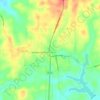
Ivanhoe topographic map

Click on the map to display elevation.

About this map

Name: Ivanhoe topographic map, elevation, terrain.

Location: Ivanhoe, Tyler County, Texas, United States (30.66618 -94.43296 30.69324 -94.39297)

Average elevation: 60 m

Minimum elevation: 40 m

Maximum elevation: 86 m

Other topographic maps

Click on a map to view its topography, its elevation and its terrain.

Fox Landing

United States > Texas > Tyler County

Average elevation: 34 m

Colmesneil

United States > Texas > Tyler County

Average elevation: 89 m

Town Bluff

United States > Texas > Tyler County

Average elevation: 45 m

Woodville

United States > Texas > Tyler County

Average elevation: 84 m

Gear up for your next adventure:

📦Gear Organizers - Organize outdoor equipment
⌚Smart Watches for Hiking - Track performance on trails
☕Vacuum Insulated Flasks - Keep tea or coffee hot for 12 hours on the summit
🪶Down Jackets - Warm jackets for cold outdoor trips
🛌Cold Weather Sleeping Bags - Warm sleeping bags for colder hikes

As an Amazon Associate, this site earns from qualifying purchases at no extra cost to you.