Geolocate

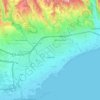
Limassol topographic map

Click on the map to display elevation.

About this map

Name: Limassol topographic map, elevation, terrain.

Location: Limassol, Limassol Municipality, Limassol District, Cyprus, 3085, Cyprus (34.52529 32.87327 34.84529 33.19327)

Average elevation: 176 m

Minimum elevation: -5 m

Maximum elevation: 1,046 m

Other topographic maps

Click on a map to view its topography, its elevation and its terrain.
Paphos Municipality

Cyprus > Cyprus

Average elevation: 57 m

Limassol

Cyprus > Cyprus > Limassol Municipality

Average elevation: 71 m

Gear up for your next adventure:

🧿Weather Radios - Track weather in remote places
🗾Ireland Map Books - Top map books for exploring Ireland
🪓Camping Hand Axes - For processing wood during forest camping
🧥Gore-Tex Rain Jackets - Breathable and fully waterproof shells for Irish weather
🛌Cold Weather Sleeping Bags - Warm sleeping bags for colder hikes

As an Amazon Associate, this site earns from qualifying purchases at no extra cost to you.