Geolocate

Renfrew topographic map

Click on the map to display elevation.

About this map
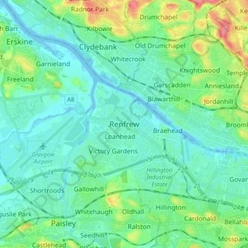
Name: Renfrew topographic map, elevation, terrain.

Location: Renfrew, Renfrewshire, Scotland, PA4 8TS, United Kingdom (55.83757 -4.42888 55.91757 -4.34888)

Average elevation: 16 m

Minimum elevation: -7 m

Maximum elevation: 75 m

Other topographic maps

Click on a map to view its topography, its elevation and its terrain.

River Cart

United Kingdom > Scotland > Renfrewshire > Renfrew

Average elevation: 6 m

Gear up for your next adventure:

👣Waterproof Leg Gaiters - Keep bog water and debris out of your boots
🧢Waterproof Caps - Keep rain off your face and glasses while hiking
🥾Lightweight Hiking Shoes - Light, breathable shoes for trail walking
🥾Men's Waterproof Boots - Sturdy footwear for wet and boggy Irish terrain
🧊Winter Boot Traction - Grip for icy paths in the Mourne or Derryveagh mountains

As an Amazon Associate, this site earns from qualifying purchases at no extra cost to you.