
Fernitz topographic map
Interactive map
Click on the map to display elevation.
About this map
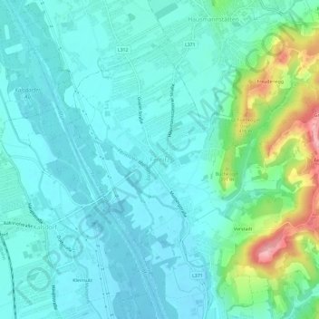
Name: Fernitz topographic map, elevation, terrain.
Average elevation: 337 m
Minimum elevation: 309 m
Maximum elevation: 449 m
Other topographic maps
Click on a map to view its topography, its elevation and its terrain.
Dillach
Österreich > Steiermark > Bezirk Graz-Umgebung > Fernitz-Mellach
Dillach, Fernitz-Mellach, Bezirk Graz-Umgebung, Steiermark, 8072, Österreich
Average elevation: 341 m