Geolocate

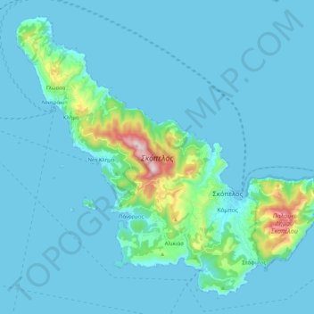
Skopelos topographic map

Click on the map to display elevation.

Skopelos

The second largest settlement is Glossa village, situated on the northwestern tip of the island, just above Loutraki harbour, with an elevation ranging from 200 to 300 m (656 to 984 ft). It is 25.4 km (15.8 mi) from Skopelos town. It is a tranquil village with traditional houses, with 993 residents.

Wikipedia (CC-BY-SA 3.0)

About this map

Name: Skopelos topographic map, elevation, terrain.

Location: Skopelos, Klima, Skopelos Municipality, Sporades Regional Unit, Thessaly, Thessaly and Central Greece, 370 04, Greece (39.06887 23.58895 39.21144 23.79307)

Average elevation: 59 m

Minimum elevation: 0 m

Maximum elevation: 660 m

Gear up for your next adventure:

🎒Fully Waterproof Rucksacks - Submersible protection for river crossings
🌂Windproof Trekking Umbrellas - Protection during vertical Irish rain
🪶Ultralight Tents - Lightweight shelters for hikers
🛶Kayaking & Water Sports Gear - Equip for water adventures
🏃‍♀️Running Hydration Belts - Hydration on the go for runners

As an Amazon Associate, this site earns from qualifying purchases at no extra cost to you.